Mount Washington to Pierce – A Southern Presidential Traverse in April

Temperatures and wind created winter conditions on Mount Washington and all the high peaks on our Saturday hike. wind…. snow…. ice…. mud.

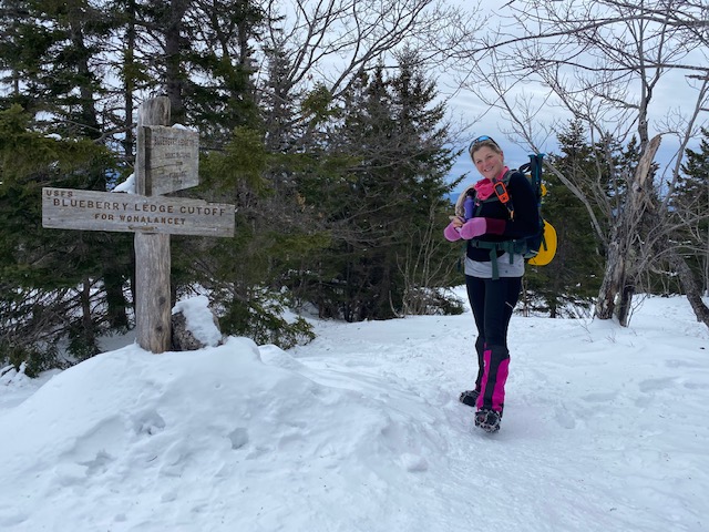
Saturday was a good day to spend some time in the Presidentials. 

We opted for Jewell Trail to Gulfside to Mount Washington. The Jewel trail was a gradual ascent to treeline. We had great views of Mount Washington once we got out of the trees. The temperature was perfect and not much wind until this point.

You can see Mount Washington between Vicky and Greg.

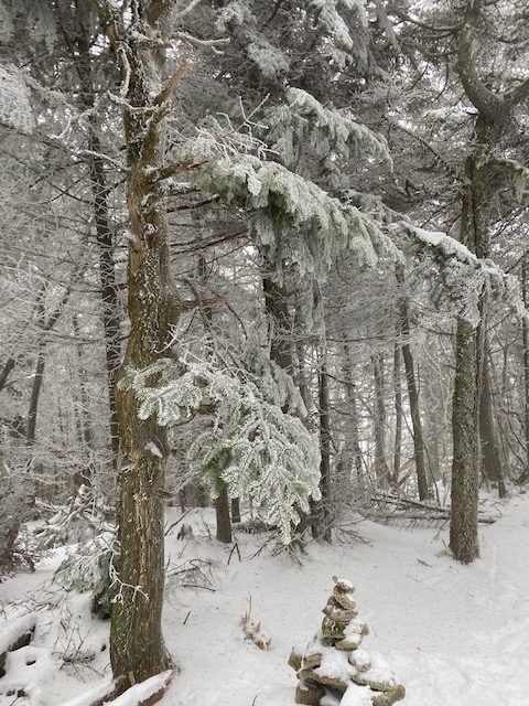
The snowfields were mostly solid and easy with spikes. 

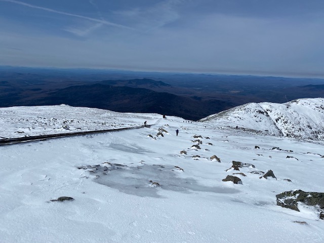
We got off trail a bit once we headed up to Washington and opted to follow the cog for a bit. We talked to some people heading down and they said the winds were 60mph. 

Yes, that was correct. The wind was brutal, just as predicted on the Mount Washington Weather page. 

Mount Washington Summit

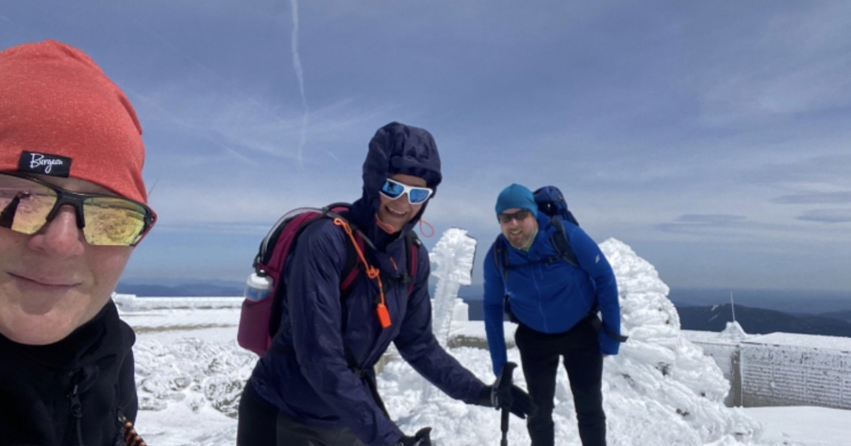
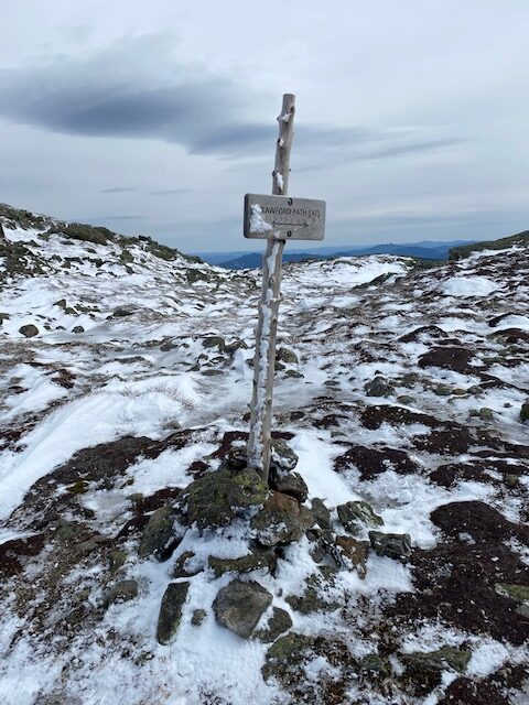
We took a bunch of pictures and made our way over the Crawford Path trail to head south and get out of the wind.  The sign was covered in snow but I remembered how to go from the traverse in October.

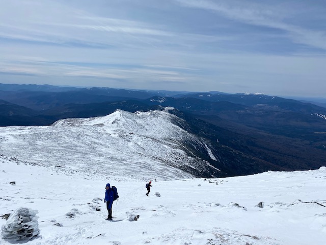
As we headed down from Mount Washington there were several steep angles we had to traverse. Some were a bit sketchy but we made it through. We thought the wind and cold would subside after descending from Mount Washington but the wind continued as we headed up Monroe.  

Heading toward Lake of the Clouds and Monroe

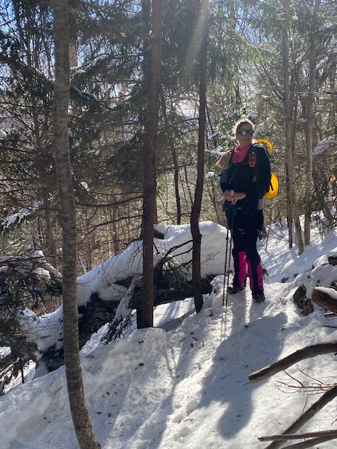
It was a day when you could switch between spikes, crampons and snowshoes every five minutes. Since this was my first time in the Presidentials in winter conditions, maybe this is just what it’s like above treeline in April. 90% spikes and 10% bare boots today.

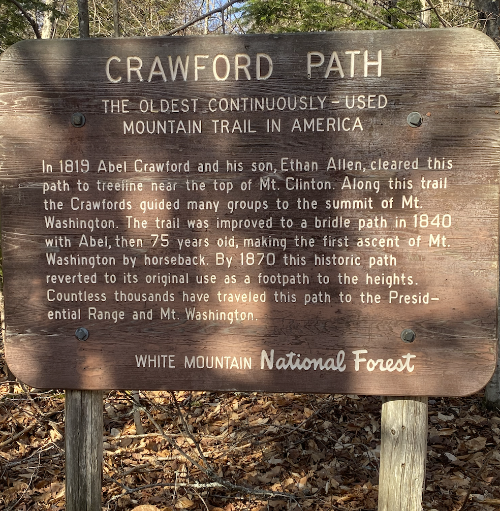
I love being on the Crawford Path. It has such an interesting history and it is so beautifully maintained with rocks lining the trail. My favorite part is heading down to the Eisenhower junction and then starting the climb up. Today there were 360 degree views at the top. I feel like the cairn on the summit gets smaller each time I’m there. 

As we headed to Pierce the wind was still pretty strong. I love this descent back into the trees a bit and then up a short hike to Pierce. Pierce is a bit boring after the summits we did but it was nice to end on this peak. We opted not to go to Jackson. 

We had sun and wind and high clouds all day. It was an epic adventure to bag Washington in full-on winter conditions. I am excited to go back and do this again next month to see what is different. 

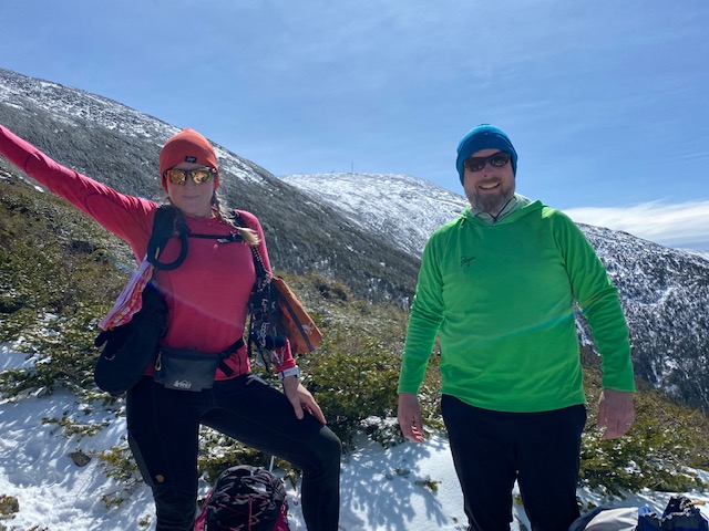
I had two great hiking partners today: Vicky and Greg. They were funny all day and were okay with leading the entire time. What a fun day. 

Next Up – Pemi Loop

Tecumseh in April

Rain threatened all day and the wind picked up at times, but overall a perfect hike to Tecumseh. The first mile is dirt trail and then just before the stream crossing spikes were needed. Some of the snow was soft but some spots were pure ice. 

I may have seen one or two black flies buzzing. With all the talk of ticks I forgot that April to June trails are  infested with black flies, which is why my grid is bare for April and May (and maybe due to ice danger). However, this month I’m making a concerted effort to hike as many 4,000 footers as I can to get some ink on my spreadsheet. 

I always forget how steep this trail is and it was great cardio going up, up, up, straight up. It’s been great practice to Hike Mount Rowe as much as I can during a work break and got me in shape for getting back to NH’s 4,000 footers and my grid. 

As I approached Tecumseh’s summit the trail diverged two ways, I went right and opted for a loop to see which side was icier. I had the summit to myself and then headed down. Each route was equally icy in different ways. 

It is always a quick run/hike down the mountain and still no rain. I got lucky today. The hike was not as exciting as last week’s hike so I’m taking it for a win.

Tecumseh for the April grid!

The day I realized I was gridding it

On Tuesday Vicky agreed to meet for a hike. We both had peaks to bag in January but we agreed on Whiteface Passaconaway. We didn’t discuss route or anything significant other than I wanted to run/hike. Vicky wanted clarification on shoe/boot type. We both wore boots and spikes. While I had visions of a bit of running it – ha – wishful thinking as always: it was a hike.

However, in the parking lot I told her I wanted to do the counterclockwise route since the granite ledges on the approach to Whiteface on Blueberry Ledge induces anxiety for me going up. Last year I did the loop counter clockwise and it was so much better going down the ledges than going up. I wanted to repeat what worked. Vicky is the most laid back, open for anything hiker friend I know. She didn’t care what route – she needed a long hike. Although I will note that three hikers who passed near the real summit of Whiteface as we headed to the ledges seemed worried for us. 

But let’s start from the beginning.

Great weather, clear skies and no wind. Dicey’s Mill to Passaconaway has a bunch of steep parts but doable. Spikes were clearly the best choice. We get to the “boring” summit (sorry but it is), but the views between trees showed us Mount Washington in its glory.

Back to Rollins Trail and the ridge.

It is on this amazing ridge where I realized that I was gridding. Where I knew I was In. I am gridding. I knew these trails. I knew where I was going. I knew this ridge. I knew where the true summit was. 

This may be the heart of why we want to know things so intimately. We know the familiarity that brings clarity. In the wilderness, things can change on a dime but yet we know trail junctions (and celebrate them) and can anticipate ledges or difficult river crossings. You know this place so well; and that is why I’m gridding because I love knowing a trail or route because I figured it out. I looked at the map and I hiked/ran/walked it over and over. I figured it out. I got oriented to this place.

Now, I know, I’m so gridding it. Every 4,000 footer in New Hampshire, in every month. Hells Ya. I say. 

This Passaconaway-Whiteface Loop is glorious. We saw two cute dogs; the one with a bell that warned us of his presence and number two had the cutest ears. Spikes were the wrong choice when we got to the ridge; soft snow. We should’ve brought our snowshoes.

While we wished for our snowshoes but wondered: would we have put them on if we had them since it was “yeah spikes” more then “we wished we had snowshoes”. I know – it’s a dilemma. So much energy to put them on. 

Vicky

We got to the place on Whiteface where I knew it was going to be tough. Vicky is fearless. She is taking in the views of the Presidentials and grabbing photos. I’m like, “Hey Vicky, I’m going to keep going.” I start the “bad part” and it isn’t really bad, yet. And I can’t remember which is the very hard part because I think there are three sections that are hard.

“Is this the bad part?” I ask Vicky.

“No, it’s coming up,” she said. 

We go past the crevasse and it’s okay. 

“Was this the bad part?” I ask Vicky.

“No, it’s coming up,” she said. 

We get to a part where I butt slide a bit and jump; but it’s not super hard. 

“Is this the bad part?” I ask VIcky.

“Yes, that was it,” she said. 

“Wow, that was easy,” I said.

And just like that, the bad part is over. I estimate it’s about 1% of the hike. Blueberry Ledge Trail was perfection. 

I’m gridding it. I have the best hiking partners. That is all.

Whiteface looking south. Can you see Gunstock in the distance?

Hiking Moosilauke via Benton Trail in November

Two weeks ago this trail looked a little different than Saturday. I attempted Moosilauke with my dogs on the Benton trail on October 18, the day after the big snow storm, and couldn’t find a good river crossing spot with the high water running, so I turned around. 

Saturday the water was much lower and I was able to cross the river and hike to the peak.

It was a good day to be in the mountains.

Tunnel Brook trail was a nice gradual walk to the Benton Trailhead. Once we crossed the river the climb began. No big boulders and no granite slabs – it was just a nice hike. 

As we arrived at the Beaver Brook trail two families with young children came up the trail. I know that trail and it’s a tough one – good for them! We hiked for .4 and came out of the woods with a short hike above the treeline to a crowded summit. 

On Moosilauke trying to get out of the wind for a break.

As I took my phone off airplane mode I got a text message from the New York Times: Joe Biden is our 46th President. I yelled to everyone on the top the great news.

It was so windy only the people closest to us heard and cheered too. 

I could see the Kinsmans in the distance knowing I would be up there the next day. And then we headed down. We only saw one other person heading up. 

Termed the quiet side of the Moose, I opted for the Benton trail since it is the easiest trail for dogs and it turned out to be both quiet and gentle. Just shy of 10 miles, it was a great hike option. Saturday wasn’t as warm at 4,802 feet than most parts of New Hampshire however Peter wore shorts and I wore regular hiking leggings.

The dogs had a great time but are definitely tired today, Sunday. Goldies 7th 4,000 footer, and Winnie’s 20th. Now it’s on to the Kinsmans today and to accomplish my goal of 48 in my 49th year.

Hiking the Tripyramids in November

Let’s get right to it and talk about how hard the Tripyramids are if you opt for the Mount Tripyramid Loop. 

Wind.
Snow.
Ice.
A slide.
Then another slide.

I’m happy to have made it through on Sunday.

We saw a few people on the Livermore Road and no one else until the second summit. Now I know why: only crazy people would hike that loop with the conditions we had on Sunday. 

The slide was long – a hundred miles – or so it seemed. Foot placement was questionable at every step.

About halfway up the North Slide, I saw footprints going off to the left, out of the wind and ice, I took it. My hiking partner chose to go right up the slide. 

After what seemed like a lifetime, the slide ended, we were out of the wind and back into the safety of the trees. Life was good again. 

Then as we got to Middle Tripyramid we saw our first hiker. All four of us were happy to see humans. 

We continued on the loop in bliss that the remainder would be fun and delightful.

We both envisioned laughter and happiness and storytelling. Then the South Slide became steeper and longer. 

Miraculously, the wind died down, the views opened up and we were off the slide, back in the woods and then shortly, a dirt path.

The 4,000 footers are no joke these days. Mid-Winter Conditions. I say. 

Be prepared. Turn back if you feel uncomfortable and unprepared.

If it wasn’t for the fact that we were prepared, we were in great physical shape, we had food and water, we had the 10 Essentials, I would not have continued. 

Be safe out there friends. Don’t take chances. Love the one you’re with LOL. 

Three more peaks until I reach my only reachable goal in 2020. Damn you Kinsmans. Please don’t be the death of me.