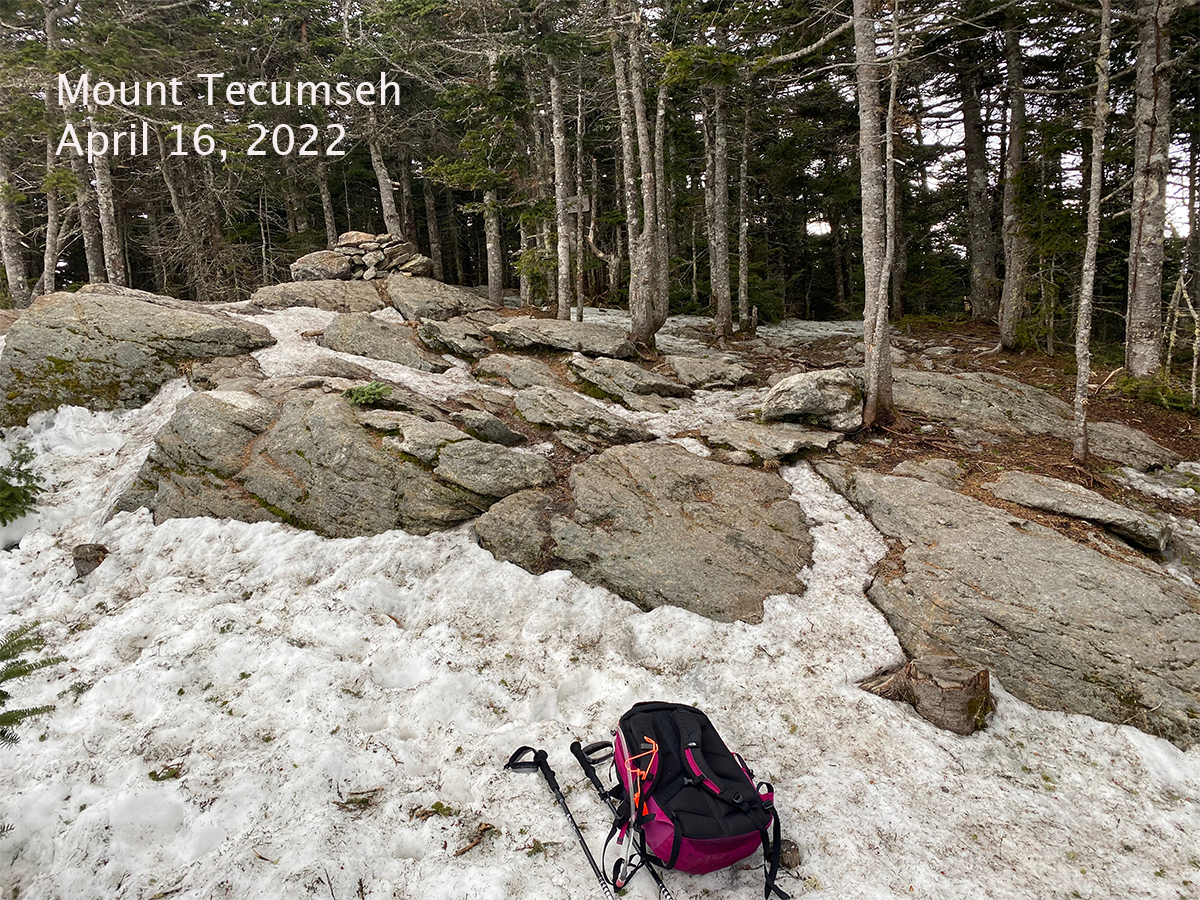
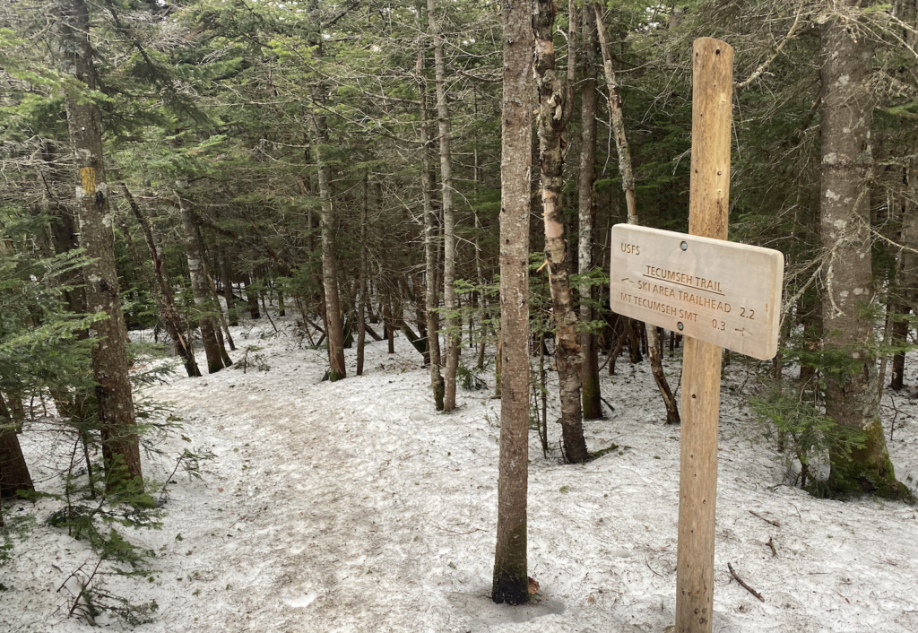
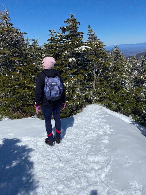
Rain threatened all day and the wind picked up at times, but overall a perfect hike to Tecumseh. The first mile is dirt trail and then just before the stream crossing spikes were needed. Some of the snow was soft but some spots were pure ice.
I may have seen one or two black flies buzzing. With all the talk of ticks I forgot that April to June trails are infested with black flies, which is why my grid is bare for April and May (and maybe due to ice danger). However, this month I’m making a concerted effort to hike as many 4,000 footers as I can to get some ink on my spreadsheet.
I always forget how steep this trail is and it was great cardio going up, up, up, straight up. It’s been great practice to Hike Mount Rowe as much as I can during a work break and got me in shape for getting back to NH’s 4,000 footers and my grid.
As I approached Tecumseh’s summit the trail diverged two ways, I went right and opted for a loop to see which side was icier. I had the summit to myself and then headed down. Each route was equally icy in different ways.
It is always a quick run/hike down the mountain and still no rain. I got lucky today. The hike was not as exciting as last week’s hike so I’m taking it for a win.
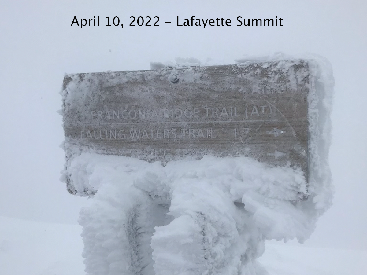
The plan was to hike the Franconia Ridge to Flume. We would start by hiking up to Lafayette and hike south to Flume, and take Liberty Springs back to the road. We would walk back to the car on the Pemi paved path.
We knew there was going to be wind and clouds at the summit of Lafayette and studied the Higher Summits forecast, so we were prepared for full-on winter conditions.
Best Laid Plans.
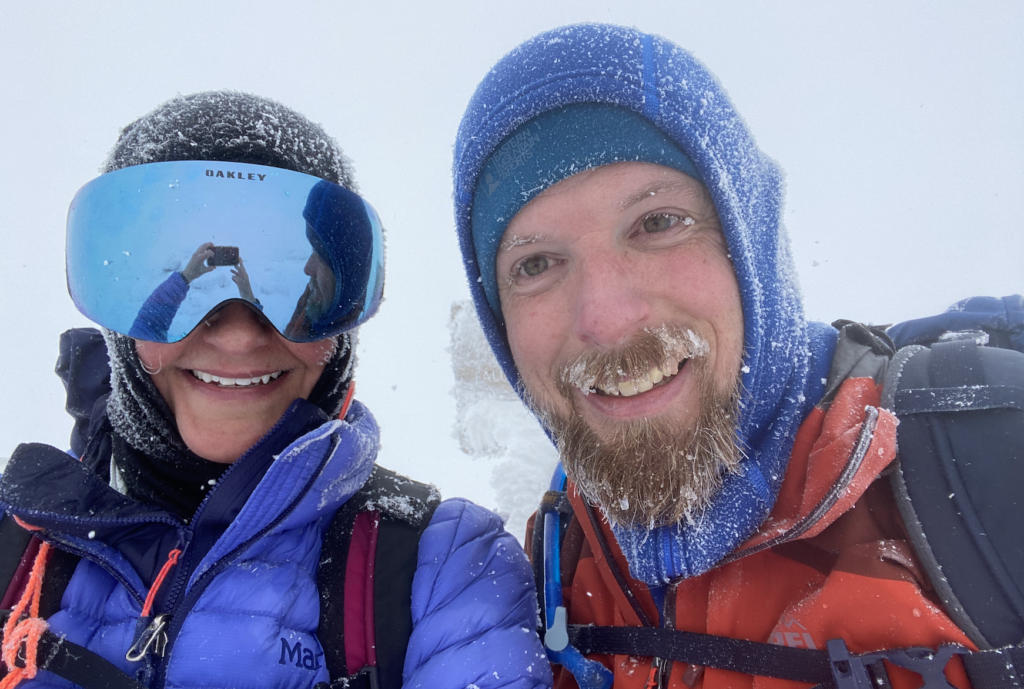
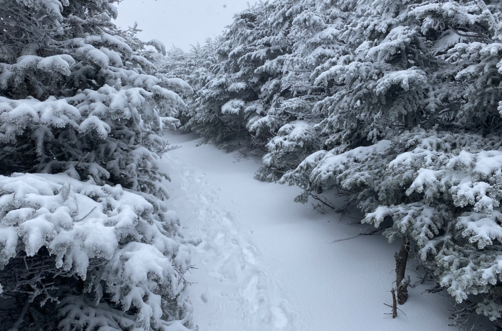
It was 37 degrees when we left Lafayette Place parking lot and started the climb to Lafayette. We wore spikes the entire time. It hailed and snowed off and on. We saw one backpacker on the way down who spent the night on the summit. After getting to Greenleaf Hut we knew that we were going to be in the clouds but didn’t know that visibility was going to be as bad as it was. As we continued above treeline we were looking for each cairn and it was starting to get tough to find the next one. Using my Garmin watch I could see we were close to the summit but couldn’t find it. After a few minutes we found the trail sign for the Franconia Ridge.
Later, we couldn’t figure out where to go to stay on the Franconia Ridge trail, visibility was bad. We stumbled around trying to get on the trail and head south but it was too uncertain.
So we made the right decision and headed back down. However, it was tough finding the cairns to get back down. I was in full panic mode. Thanks for my calm, sensible hiking partner, Greg, we looked, hiked some in the direction my watch said, looked for cairns, hiked some more. We couldn’t see our tracks in the snow due to the wind. After 5-10 minutes we found our way.
On our way down we came across two men hiking up. We told them about the poor visibility and they continued on. We worried about them.
We got back to the hut and ate lunch. We talked about the what just happened. We talked about the book we both read, The Last Traverse and about making decisions on that ridge when you want to finish what you started. Just as we were about to head out the two men arrived after getting to the summit; we were relieved.
The hike down Old Bridle Path was beautiful with the snow and we were glad to be heading down.
One of the aspects of working on the Grid is that you get to really know the mountains. All three times in the last two years that I’ve got to the top of Lafayette I hiked from the south. When I got to the summit today nothing looked familiar. It was snow covered and visibility was poor, and I just couldn’t find my way to the ridge trail. Now I just want to get back up there and get familiar with the summit and the ridge. I wonder if I did know this mountain and rock formations, would I have been able to find my way. I just want to know these mountains so well that I could find my way in any conditions.
I’ll be back up to Lafayette next month for sure.
Hiking with Greg is always an epic adventure and today was one for sure. Turning around was the right decision and we will do it another day. This was the first time I have been above treeline in winter conditions. In the three years I’ve been winter hiking, I’ve never hiked Franconia Ridge or the Presidentials in winter; because I’m not ready (yet) for that experience. I need more training and winter gear. However, I was excited to wear my goggles hiking for the first time. Now, bring on spring hiking!
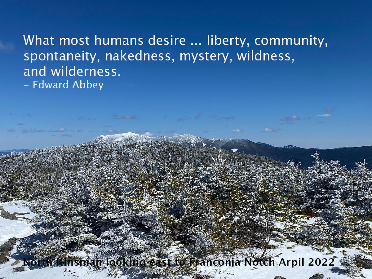
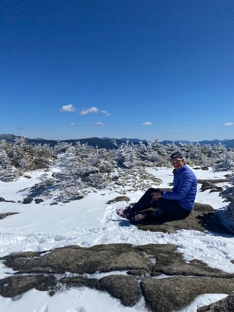
On Monday I hiked with Vicky to the Kinsmans. It was a glorious trail (Mount Kinsman Trail to Kinsman Ridge Trail), and beautiful day (blue skies, 30ish degrees) and the views all around us were spectacular (Cannon, Franconia Ridge, Loon ski slopes).
It was a good day.
Vicky, Kinsman Ridge Trail
We opted for the gentle Mount Kinsman trail and it was a great choice. My last Kinsman climb was on the Basin Cascade trail to Kinsman Pond trail. While that was a good hike, it was a bit sloggy on Cascade, this one was an easier option. Overnight the mountains got about 2 inches of snow so the hike at our 10am start was a winter wonderland. The snow was grippy over ice that seemed porous. We didn’t put spikes on until the second mile.
Once we turned on the Kinsman Ridge trail the views across the valley could be seen. The bluest sky ever against the freshly fallen snow on the trees made the day seem magical. The wind was cold but not too bad. When we made it to South Kinsman and took a break, we were able to get out of the wind and just be in awe of a perfect day.
The trail was hardly recognized on the way down. All the snow melted and it seemed like a completely different trail. At the trailhead we talked to a couple who were gridding and shared fun hiking stories and inspiration to finish the grid. Then we drove over to Lincoln for an early dinner at Black Mtn Burger Co.
My last big hike was October 2021 when Greg and I traversed the Presidential Range. That is too long to be away from the mountains.
All winter I focused on running and didn’t hike at all; this was a mistake.
Everything has changed.
My plans for training and racing have changed.
Spending Monday on trails and bagging two 4,000 footers for the grid is a reminder to me what is important and what I need.
I need the mountains and they need to be incorporated into my training and life.
I want to be successful at every race. I want to execute my plan and cross the finish line. I want to train correctly for each race.
However, for Antelope Canyon I didn’t run on sand or in similar conditions. I executed my nutrition strategy but after 15 miles my legs were dead. Mentally I was done. I continued to the next aid station and walked back to the start. 20 miles completed. Not 50.
I felt so different in the race compared to the 55K in December. I never got to the point of dead legs. Perhaps because I ran on similar terrain leading up to the race and I knew the course a little bit better. Maybe I was a bit dehydrated from traveling and didn’t drink enough electrolytes.
I do know I need to do more strength training.
I do know I need to practice mental strength.
At dinner after the race Mary, Kassandra, Stoddard and I talked about our “why”. What makes you keep going when you don’t want to? Mary suggested anger at people can help you get to the finish. I said my why is “it’s what I do”. But I don’t think that is going to work anymore.
Here’s what I think my WHY needs to be right now:
I want to run and finish races in places I’ve never been as a way to see the world. I want to have a smile on my face during most of the race. I want to be fit. I want to have a goal that I’m working towards every day.
My goal for Antelope Canyon was to finish. And I didn’t. Sometimes it takes me two tries to finish a race on a new course. I’d like to think that this year is my year to cross the Leadville finish line (second attempt).
I have some work to do.
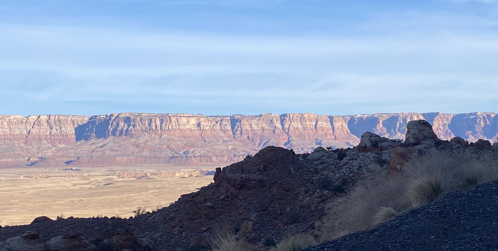
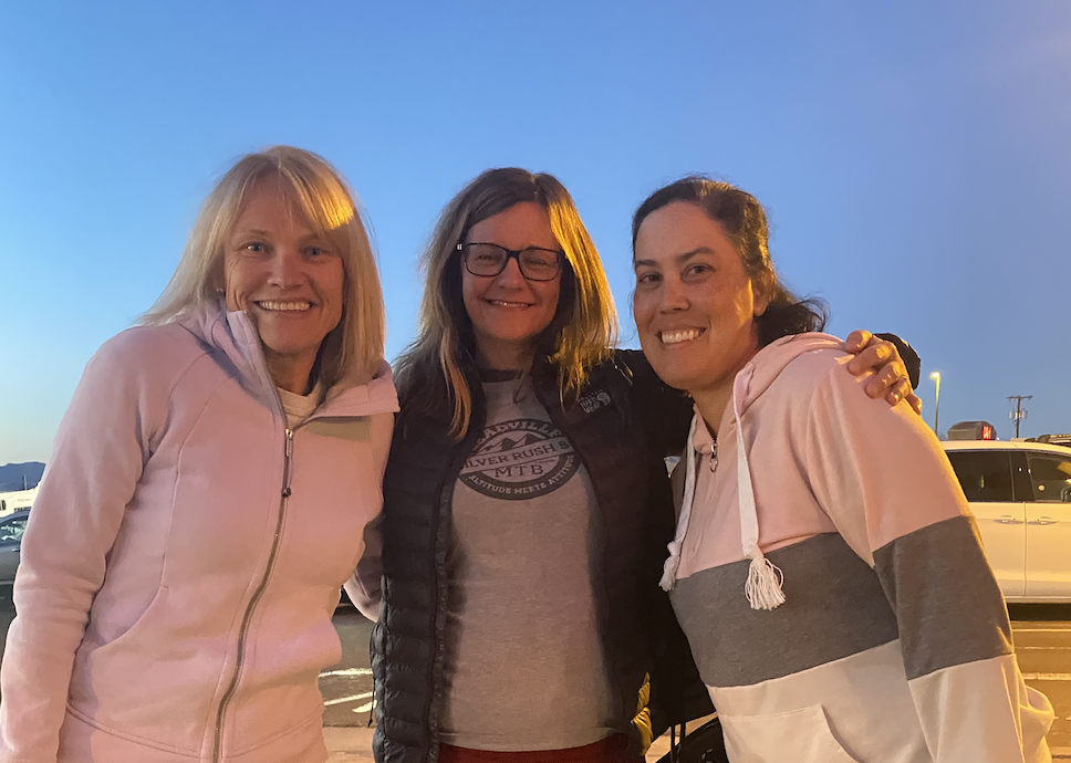
The race weekend was fun despite not finishing. I met three friends in the desert and we shared stories and laughed. We caught up on what is going on in our lives and ate good food in Page, Arizona. The weather was fantastic: sunny blue skies all day long. I drove through beautiful northern Arizona with canyons and juniper trees and prickly pears. It was a great weekend of seeing new places, running in the slot canyons, seeing friends and being amazed at the world. I can’t wait to do it again.
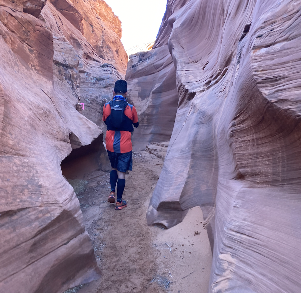
Antelope Canyons, the second slot canyon on the course.
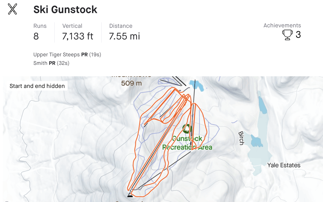
Today is an 18 mile run. I was supposed to do it yesterday but Monday was a big day at the mountain. And I got to ski for a bit since I hadn’t skied in weeks. Conditions were amazing and I got 8 runs in. It is always great to get out there and talk to people on the lifts. I always say I have the best job in the world and yesterday proves it, to me at least.
Tiger Steeps, my favorite trail
But today and a big run.
It is the first big run since getting sick and I have two weeks until the 50 miler. I looked back at my training for my first 50 in 2019 and I had two 30 mile training runs before that race. I think that will be telling for my results this year. So many things are different so it’s tough to do a true comparison but I just want to get to Arizona, hang out with friends, and run on the Navajo land to experience the magic.
Then once I get back it’s all about building more mileage, getting strong, skiing a bunch, winter hiking and being the mountain girl that I am.