I drove north to Ranson, West Virginia for a race. I had an hour or two before the festivities so I drove over to Harpers Ferry National Historical Park. I did a little research prior to arriving, but it didn’t prepare me for what I saw.
I think I was expecting to see a few historical buildings related to John Brown and typical exhibits related to it. But it was so much more. This continues my pattern of researching a little, going to see something and learning so much – and realizing I need to go back to take full advantage of the area.
I took the shuttle from the Visitor Center because I didn’t think I could drive in and it was a great option. Later I found out you can drive but parking is pricey. Plus, if I drove I wouldn’t have experienced everything I did walking. I walked through the village and read the interpretive signs.
I saw the building that John Brown raided which was an insurrection against slavery.
Brown’s arrest and execution sparked outrage and became the defining moment in the abolitionist movement. That’s what I remember about Harpers Ferry from history and reading, but then I walked towards the water and I realized that the Appalachian Trail ran through here.
It is also the convergence of two main rivers: Shenandoah and Potomac; and three trails:
I saw the white AT markers and followed it to a ramshackle bridge and active railroad tunnel.
I saw a through-hiker who looked very tired. I followed the trail for a bit through town to see where it took me. Up Up Up on cobble stones and to a better view of the tunnel and the rivers.
I walked back through the town and looked at the exhibits and learned more about the civil war battles and Storer College, a historically Black college that operated from 1867 to 1955.
What a historical place. So much to learn and understand. I didn’t have a lot of time so I know I’ll be back, hopefully while hiking the AT.
I wake up at 4am to get into Glacier National Park before 6am because I don’t have a reservation. The park opened last minute reservations at 7pm yesterday but I’m in the airport looking for food and forget to log in to get a reservation.
I’m in a bit of a panic driving through Kalispell in the dark and getting to the West Glacier entrance before 6am. As I’m driving I’m trying to figure out how to charge my phone and realize my rental truck, a Toyota Tacoma doesn’t have a USB port. I panic and try to problem solve how to charge my phone and envision the entire day without a charged phone (PANIC). I stop at a gas station hoping they have a solution. I purchase a charger for the outlet and then continue on to get to the park entrance by 6am.
I make it in time and breeze through the entrance, it’s not manned at 5:30am. The sun is starting to rise and I’m relieved that I’m here. Now it’s time to get to Logan Pass and find a parking spot. It’s still early but spots fill up fast, so I don’t stop at any of the turn outs with views – I just drive to the top.
As I drive up Going to the Sun road to Logan pass there are cyclists biking too. I’m in awe of their legs and lung capacity to bike up this steep, windy road. It reminds me of my time living in Colorado when I was training for Ironman and biking up Trail Ridge Road in Rocky Mountain National Park. I lived in Granby, and the west side of the park was the “quiet side” of the park. My friends and I would bike through Grand Lake and into the park and up to the Visitor Center. That was over 15 years ago, but seeing these cyclists brings back this great memory.
I think “fit people doing amazing things in the park” hmmmm, reminding me, also of my trip west when I was 17. I was always seeing people doing amazing things or meeting people in hostels who were biking across the country or backpacking through the mountains or visiting all the parks. This trip today is all about remembering that trip 36 years ago and this is a great memory.
I think interesting, adventurous, curious people are drawn to our National Parks and I just love meeting them, and seeing them.
I can’t remember if I hiked Highline Trail with my group in 1988 but I know I wanted to hike this trail as part of my trip. It’s an iconic trail with amazing views that parallel the Continental Divide. I’m a bit obsessed with seeing and writing about the Continental Divide.
Not only does the Continental Divide split the water of our continent into different oceans but I’ve seen and lived near it for many years when I lived out west: in Granby and Steamboat. I’ve run on its ridge and love to see the sun rise over it. It’s a symbol, to me, of living western.
My heart sinks when I see a sign that the parking lot is full. I land a parking spot despite the sign. There are several spots available at 6am. I realize later that this sign just stays up all the time. I head to the trailhead but first the iconic highest point sign:
There is a sign that warns hikers that this trail is hot and exposed. Do you have 3L of water? Do you have sunscreen? Yes and Yes. I continue on.
The first wildlife I see is on the trail the first 10 minutes – a Mountain Goat. It looks over at me and continues chomping on grass. I keep walking and I’m in awe.
Garden Wall and the Continental Divide loom ahead. The view of the valley and mountains is like nothing I’ve seen.
I’m still not sure how many miles I’ll hike. Ideally I’d like to make it to the chalet and then turn back. In retrospect I should’ve done the loop and taken the shuttle back, but I didn’t want to rely on a shuttle in case I’m stuck in heat or rain. So I opt for an out and back.
This trail didn’t even open until July 11 and it’s July 29. Going to the Sun Road didn’t open until June 22. I see only snow on the high peaks in the distance. I really only picked these dates for the only open date at Glacier Park Lodge; everything was planned around the one night there, for tonight. But I digress. My hike:
I am following Garden Wall and am always looking up to my right. There are parts of that trail that seem long and flat, and there are some up and down. I hike past the ledge that hangs like a shelf but wasn’t really bothered by the trail. I held on to the hand cables a few times. I don’t have a fear of heights, a fear of many other things, yes, but not this. I could see the Going to the Sun Road below me and just didn’t look down much.
I opt to turn around at 6.5 miles because there is full sun exposure and I’m getting worried about the trek back. I know I’m close to the trail to view Grinnell Glacier but I’m okay with turning back. I’ve gone farther than the original plan and am ready to go back.
There are so many hikers and I listen to conversations. I hear one group talk about getting to the chalet for their overnight stay and I’m a bit jealous. I see families with children and two couples with a child in a carrier. I just hope they all have sunscreen and plenty of water. When I started out much of the trail was in the shade and now most of it’s in full sun. I lather on the sunscreen and hope I don’t fry.
Going back the way I came is a different experience. I see everything I didn’t look back to see; one benefit of an out and back. This trail is spectacular and as I hike I know I want to come back and do the loop so I can see the chalet. I hike past the rock slide that has purple rocks. I saw it going out and the purple shade of the shale are stunning. This time, I take a rock as a reminder of this hike. This theft reminds me of my past thievery from Mount Washburn in Yellowstone National Park during my Western Park hiking adventure in 1988. I took a rock from the summit and I had it as a souvenir for many years. I realized I didn’t have it anymore and it got lost in moves. I forgot about that rock until just this moment. This trip is all about remembering something special and that Mount Washburn rock memory was part of it.
I get back to Logan Pass and I’m thrilled that I didn’t run into a grizzly and that I’m not burned to a crisp from the sun. I go to the Visitor Center and look around at the interpretive signs. I’m too tired to hike the trail to Hidden Lake which is just past the Visitor Center. It’s a 5 mile out and back. I think to myself, I’ll do it on the way back to Kalispell tomorrow after Grinnell Glacier.
Now it’s time to look for food. As much as I’m a planner, I didn’t research places to eat east of Logan Pass. It turns out to be the hardest part of the day.
I’m driving east on the Going to the Sun Road heading to St Mary’s Visitor Center area. I stop at the Jackson Glacier viewing and wish I was hiking toward it. Jackson Glacier is the 7th largest of the 25 glaciers in Glacier National Park. As I write this my plan next year is to hike in this area.
I continue on in search of lunch/dinner.
Unexpectedly, I see a traffic jam ahead. Initially I think it’s an accident. As I get closer I notice people looking to the north and their cameras are out.
I look over and it’s a freaking Grizzly bear chomping on grass. I see the cinnamon color on his back and the sun reflecting on him and I’m thrilled. I’ve never seen one. I don’t stay long because I’m starving and need food. In retrospect I should’ve stopped but I always feel like gawking at wildflie is the wrong thing to do so I continue on. Again, in retrospect, I should’ve gawked and taken photos.
I stop at the Visitor Center, where I miraculously find a parking spot. I go in, walk around and don’t buy anything. I am just hungry and need food. As I turn east, I see a restaurant sign hanging on a building in St. Mary’s Village just outside the park. I enter the building not knowing what I will find and by some, again, miracle, there is no waiting line and I sit at a table and order food.
I eat a real meal: a bison burger and bison chili, and a Montana brewed IPA. As I take in everything: the hike, the experience, the road, the people, the lakes, the rivers, the mountains – I did everything today that I planned to do. This is a big day.
I drive to East Glacier and home for the night at the historic Glacier Park Lodge where I visited in 1988. This is the place where I bought a postcard from its gift shop while staying down the street in a hostel. I have a memory of the lodge and this trip is partially about going back and staying in this lodge.
The lodge is as grand as I remember, or remember from the postcard. The room is not worth the nightly rate and I’m disappointed but the view from the back porch is worth everything.
Distance: 13 miles. Time: 4 hrs, 48 mins What I ate: GORP, Kind Protein Bar What I drank: 2.5 L water What I wore: an old backpack, Title Nine skort, t shirt, Columbia long sleeve hiking shirt, Pistol Ultra baseball hat. What I saw: Mountain Goat, awesome views
The road to Grinnell Glacier in the Many Glacier area of Glacier National Park is very remote and I’m a little nervous as I drive from East Glacier to the Grinnell Glacier trailhead. Yesterday I hiked the Highline Trail and probably didn’t eat and drink enough so I’m feeling under fueled. It’s 6am and the only thing I’ve eaten is a granola bar and water. I left Glacier Park Lodge at 4:30am and nothing is open to get a real meal before this hike.
I enter the park with my bought-yesterday reservation to enter Many Glacier after 6am. I’m not feeling great about today’s hike and I see a sign for Many Glacier Hotel. I turn left into the parking lot to procrastinate my hike and explore this historic hotel. I park and walk into the lodge. There just so happens to be a beautiful breakfast buffet and I know this is my chance to fuel up and go into the Grinnell Glacier hike with a great mindset.
I eat a full buffet breakfast: eggs, bacon, fruit, potatoes, coffee. I drink a second cup of coffee. To top it off, I have a view of Swiftcurrent Lake. I’m now in the right mindset. I’m not rushing. I’m not worrying. Well, maybe a little bit. I worry about getting a parking spot at the trailhead which fills up fast, like everything here in the summer at Glacier National Park.
Additional good fortune: the weather is working for me – it’s overcast, cloudy and threatening rain. Yesterday on Highline trail after 10am I was in full sun burning to a crisp, or so I thought.
After a full breakfast and contemplating my life mesmerized by the lake, I’m ready to hike to the glacier I hiked when I was 17. You see, I’ve been preparing for this hike for a while. I’ve been weightlifting, running and hiking. I’m 36 years older and know I need to be ready. I want to see that freaking glacier.
I’m hiking solo but I have my InReach Mini 2 active and am communicating my plans with my BFF Mark. I’m not carrying bear spray but I do have bear bells.
I land a good parking spot and head out on the 5 plus miles to Grinnell Glacier. There are bear warnings posted. I am hiking this trail solo only because it is a super popular trail and I don’t think I’ll be alone much.
I try to stay close to other hikers. I pass a group and look for the next group. I think I hike fast because I’m scared. And I’m trying to get through being scared faster. I keep looking for people and there’s tons of them; I’m rarely alone.
When I do have alone moments I sing songs. Out of nowhere comes a song I haven’t sung in a while. I’m deep breathing and these lines come out of my mouth “I’m just breathing, breathing in and out. Trying to get through this thing called life.”
The last time I sang this song, not outloud, was when I was swimming in the Gulf during Ironman Florida. It’s such a great song. I’m trying to find people and hike with them for a little bit but then when I can’t I sing this song as loud as I can to keep the bears away:
“I’m just breathing. Breathing in and out. Taking it all in and I’m living with some doubt. I’m just breathing and I’m trusting in your words, knowing you can hear me Lord. You always take my breath away, sometimes you take me by surprise.”
I talk to a lot of people and I get to the glacier overlook. The glacier is amazing. I don’t necessarily remember it but I’ve read so much about the glacier and how it has receded that I feel like I know it. I’m so happy to be here. It was a hard hike especially after yesterday’s hike. I rejoice in the beauty and not seeing a grizzly.
I take a few pictures then head back.
I am wearing my Knoxville Motus race shirt on this trail because it’s the best feeling shirt next to my skin, and it wicks sweat a bit. I like being comfortable. A group passes me as I head down and the last man looks at my shirt and then asks me, You from Knoxville? I say yes. He tells me he is from Winchester. I say, isn’t it great to be out west? He smiles and asks, You a Vols fan? I say, don’t you have to be?
I pass the family that offered to hike with them on the way up. They have a five-year-old daughter hiking the entire trail, which impressed me more than anything. I love seeing young kids hiking these trails; it will be a memory to last a lifetime, I’m sure of it. The father tells me there is a Bighorn Sheep ahead that I will see; I’ve never seen one.
This is a life affirming hike today because I am fortunate for so many things at this moment. I’m so thankful and I pray a lot during this hike. I think about how I do so many of these adventures scared. I moved to Tennessee scared. I hiked Mount Washington in winter, scared. I left a bad job scared. I just do things scared. I’m very thankful for my friends who talk me down from the ledge when I get overwhelmed from doing things scared.
As I hike back to my car, I’m so thankful to have a good day and that I get the chance to come back and visit this place I love.
36 years ago I had no idea what my future held; I still don’t. Montana was always my dream; I say this all the time. Meaning that I thought I would live in Montana and make a life here one day. Maybe it was just a dream about a place to visit and get to know over time. Who knows; there’s always time, there’s always time.
Regardless, today’s hike was one of the best days of my life.
Distance: 10.2 miles. Time: 3 hrs, 51 mins What I ate: GORP, Kind Protein Bar What I drank: 1 L water What I wore: Salomon hydration vest, rabbit Speed Leggy Shorts, Motus race top, Glacier National Park hat. What I saw: Big Horn Sheep, mule deer, hoary marmot, columbia ground squirrel
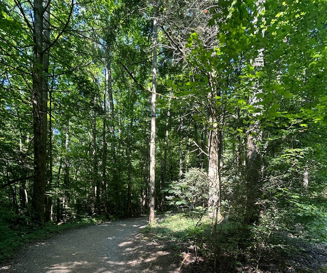
I have been wanting to do this hike for a long time. I wanted to see about the swimming hole and to hike on the North Carolina side of the Smokies. But really, I just love the name: Big Creek. A big name and a famous swimming hole.
The trail was a perfect option the day after a big trail run. It was a gradual ascent and felt like a leisurely hike up the creek; despite Strava saying it was a 919 foot descent for 3.5 miles
The swarming bugs and spider webs were in full force this morning. Ugh. We saw lots of horse poop and eventually two horses.
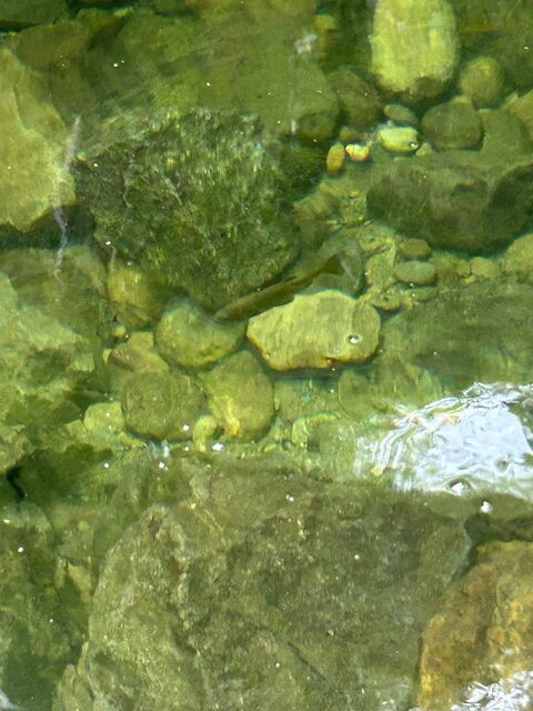
We stopped at Midnight Hole and saw fish in the water. Can you see it in the photo below, between the two rocks?
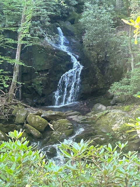
We saw Mouse Creek Falls cascading into Big Creek.
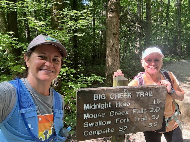
We crossed one bridge and chatted with a couple from Michigan who were heading up for an overnight backpacking trip. They told us the Backcountry Campsite 37 was closed due to bear activity, which I didn’t know about. Once I got home I verified this on the park’s website, and yes, it is indeed closed.
I’ve been thinking about getting one for a few months now and it’s time to invest. I plan to spend a lot of time on trails this year, and every year for that matter. It’s time.
Since this was my first time on Big Creek trail I didn’t know that the creek is usually much higher. Melani, who I frequently hike with said that the water is very low. It’s very dry in Sevier County; we need rain. The forecast is calling for clouds and thunderstorms this week. Here’s hoping it’s just rains.
It was a good day to be on the trail.
Distance: 7 miles. Time: 2 hrs, 37 mins What I ate: peanut butter and jelly sandwich. What I drank: .5 L water What I wore: Salomon hydration vest, CW-X compression shorts, Motus race top, Pistol Ultra baseball hat What I saw: fish in the water (trout maybe), 2 horses, a few butterflies, 6 trail runners, 15 hikers going to the water hole.
Today’s hike on Ramsey Cascade trail in Greenbriar was steamy on this Saturday in July. All the giant tulip poplar trees and ferns and wildflowers created a temperate rainforest. I’m was dripping sweat. Fortunately, there were several stream crossings and places where I could splash cool-ish water on my face and dip my hat into the water to cool off.
The hike was as tough as always, even as I get into better shape, it’s still a killer climb: rocks, roots and ladders.
As I climbed higher and surrounded by leafy green trees, I had to stop in my tracks to listen. A bird sings, loudly, and the Ramsey Prong of the Little Pigeon River roars. I’m not sure what the bird was but what a beautiful song to listen to in this moment. Watch here.
I continue on with only four people coming down ahead of me. We all got early starts.
I approached the falls and it was as spectacular as always. This was my fifth time hiking Ramsey Cascade. This time I walked through the water and got as close as I ever have to the falls and filmed it. The cool air from the water felt so good. Watch here.
I waved to the two hikers eating sandwiches on the big rock; we were all so happy to be in this place.
I turned around and headed down the trail.
Michael Frome wrote in his popular book, Strangers in High Places, about Ramsey Cascade and Arthur Stupka who back in the 50s and 60s led the annual Spring Wildflower Pilgrimage in the Smokies, “We all hike … for different reasons. Some take to the trails for solitude … others look for natural beauty, finding their wonder in the trees, wildflowers, and wild animals. The scientists hike in order to study and advance the knowledge of the human race about the planet on which it lives. Others want to match their muscles and stamina against the long trails to the highlands. It does not make much difference really, why we hike, or tramp, or walk as long as the trails and the expansive natural environment are there so we can do these things. ” (326)
I’m in the later category, I always have been.
As I get closer to my car I notice Swallowtail butterflies lining the trail. They form bunches and then fly off together as I pass. I see more in the parking lot and the road back to Route 321. I don’t know that they are Swallowtails until I get home and Google it.
It was a good day to be on the trails.
Stats:
Distance: 8 miles. Time: 3 hrs, 5 mins What I ate: half peanut butter and jelly sandwich, one granola bar, a few handfuls GORP What I drank: a bottle tailwind endurance fuel, 1 L water What I wore: Salomon hydration vest, CW-X compression shorts, Little Rock marathon race top, L100 baseball hat What I saw: Swallowtail butterflies, not many people, majestic 90 ft waterfall