Springtime on Lafayette

The plan was to hike the Franconia Ridge to Flume. We would start by hiking up to Lafayette and hike south to Flume, and take Liberty Springs back to the road. We would walk back to the car on the Pemi paved path.

We knew there was going to be wind and clouds at the summit of Lafayette and studied the Higher Summits forecast, so we were prepared for full-on winter conditions. 

Best Laid Plans. 

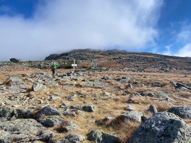
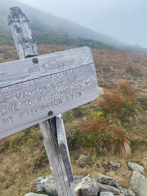
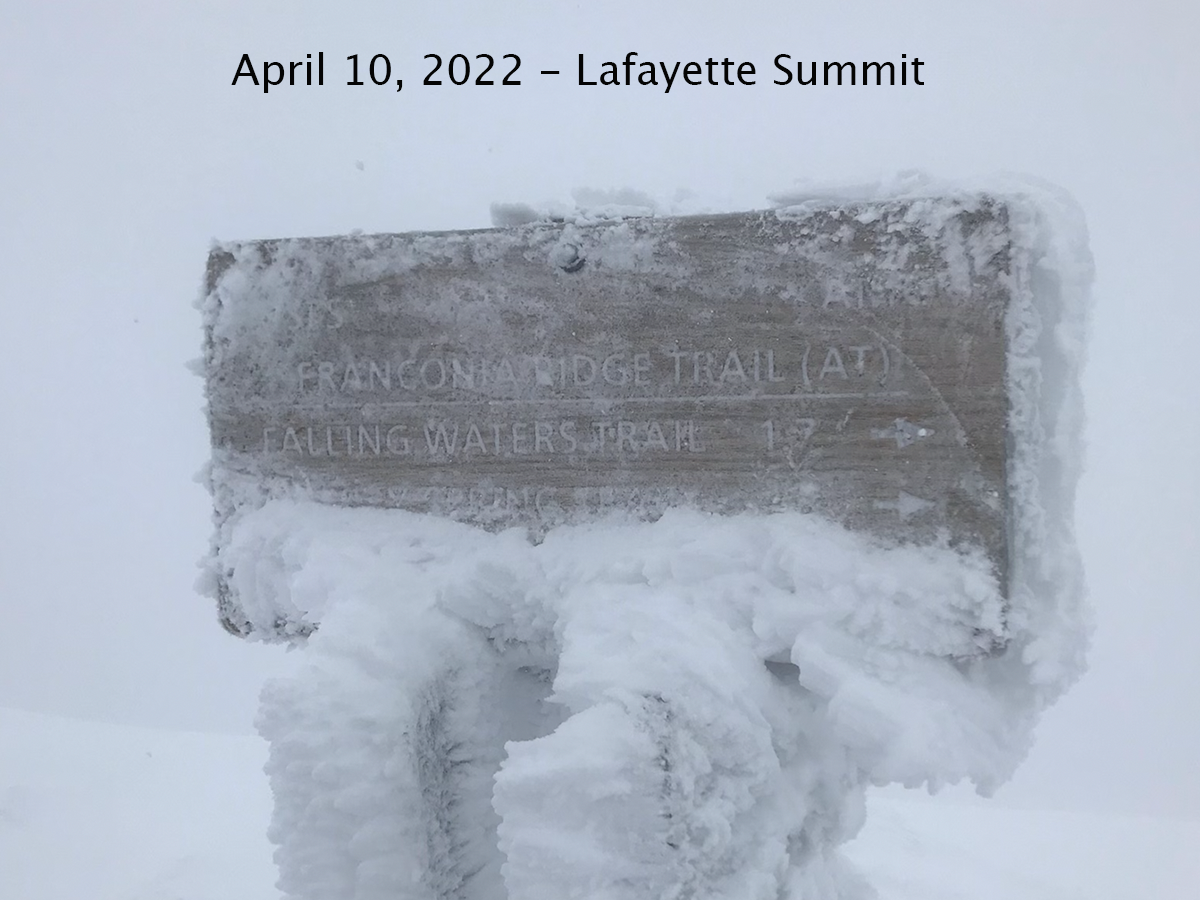
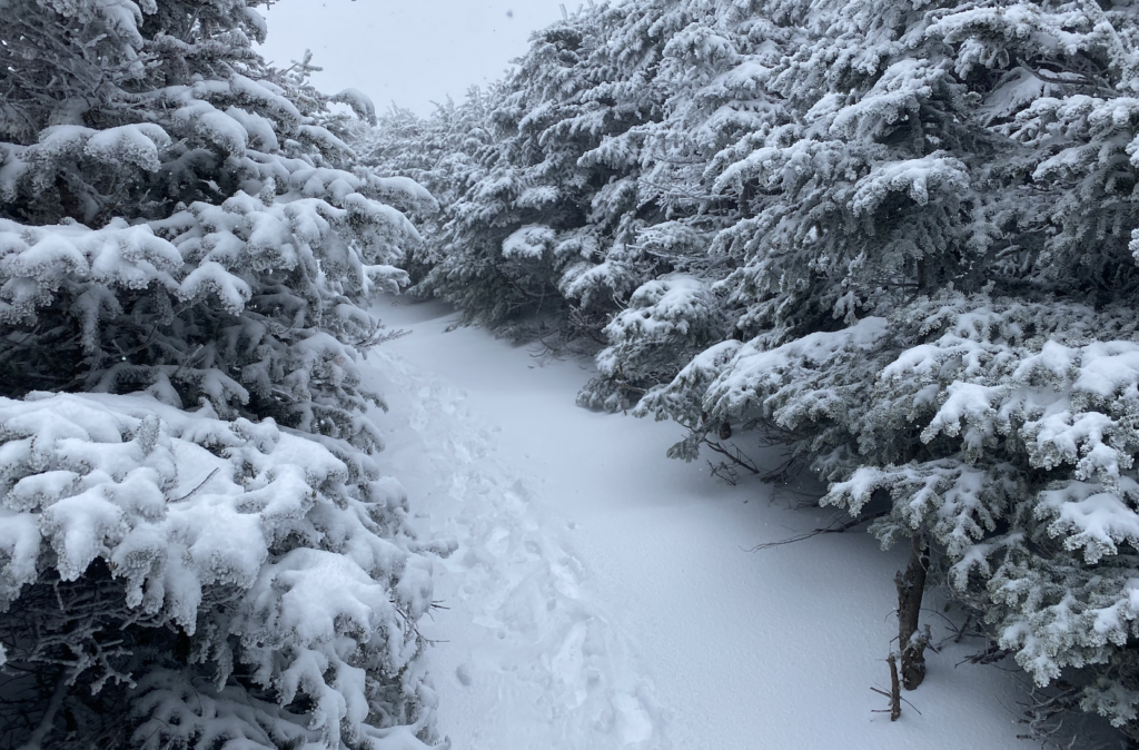
It was 37 degrees when we left Lafayette Place parking lot and started the climb to Lafayette. We wore spikes the entire time. It hailed and snowed off and on. We saw one backpacker on the way down who spent the night on the summit. After getting to Greenleaf Hut we knew that we were going to be in the clouds but didn’t know that visibility was going to be as bad as it was. As we continued above treeline we were looking for each cairn and it was starting to get tough to find the next one. Using my Garmin watch I could see we were close to the summit but couldn’t find it. After a few minutes we found the trail sign for the Franconia Ridge. 

Later, we couldn’t figure out where to go to stay on the Franconia Ridge trail, visibility was bad. We stumbled around trying to get on the trail and head south but it was too uncertain. 

So we made the right decision and headed back down. However, it was tough finding the cairns to get back down. I was in full panic mode. Thanks for my calm, sensible hiking partner, Greg, we looked, hiked some in the direction my watch said, looked for cairns, hiked some more. We couldn’t see our tracks in the snow due to the wind. After 5-10 minutes we found our way. 

On our way down we came across two men hiking up. We told them about the poor visibility and they continued on. We worried about them. 

We got back to the hut and ate lunch. We talked about the what just happened. We talked about the book we both read, The Last Traverse and about making decisions on that ridge when you want to finish what you started. Just as we were about to head out the two men arrived after getting to the summit; we were relieved. 

The hike down Old Bridle Path was beautiful with the snow and we were glad to be heading down.

One of the aspects of working on the Grid is that you get to really know the mountains. All three times in the last two years that I’ve got to the top of Lafayette I hiked from the south. When I got to the summit today nothing looked familiar. It was snow covered and visibility was poor, and I just couldn’t find my way to the ridge trail. Now I just want to get back up there and get familiar with the summit and the ridge. I wonder if I did know this mountain and rock formations, would I have been able to find my way. I just want to know these mountains so well that I could find my way in any conditions. 

I’ll be back up to Lafayette next month for sure. 

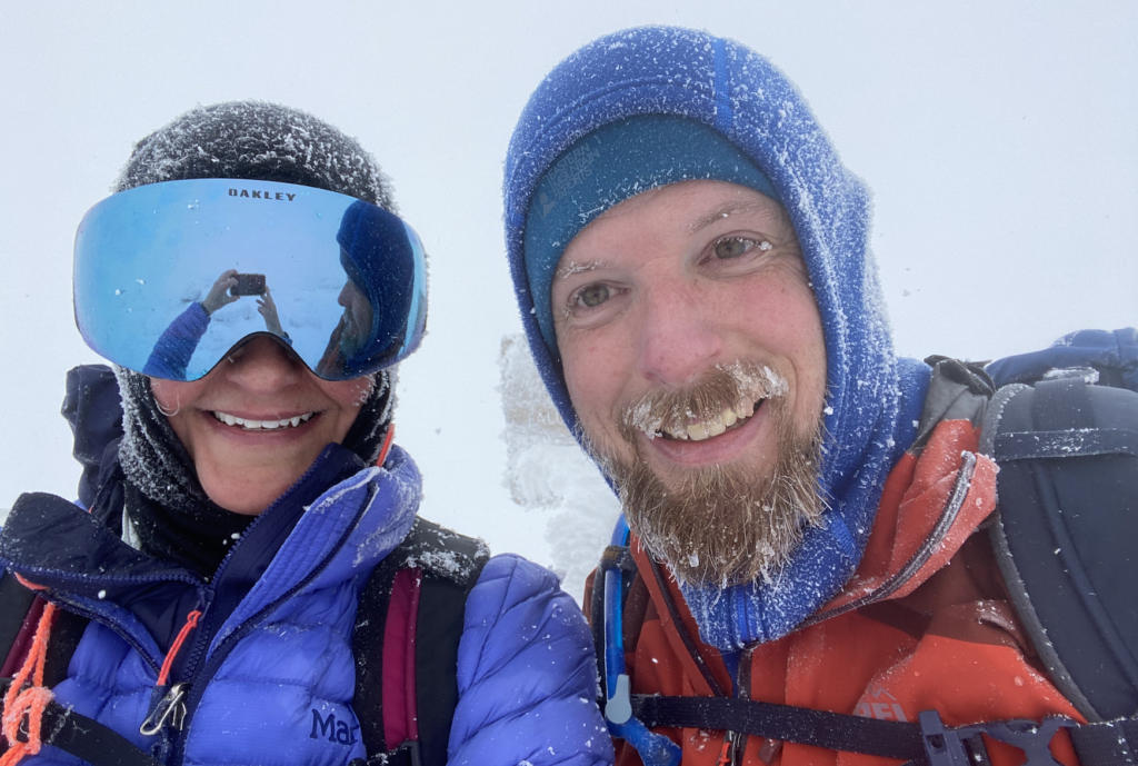
Hiking with Greg is always an epic adventure and today was one for sure. Turning around was the right decision and we will do it another day. This was the first time I have been above treeline in winter conditions. In the three years I’ve been winter hiking, I’ve never hiked Franconia Ridge or the Presidentials in winter; because I’m not ready (yet) for that experience. I need more training and winter gear. However, I was excited to wear my goggles hiking for the first time. Now, bring on spring hiking!

Getting clarity on the Kinsmans

On Monday I hiked with Vicky to the Kinsmans. It was a glorious trail (Mount Kinsman Trail to Kinsman Ridge Trail), and beautiful day (blue skies, 30ish degrees) and the views all around us were spectacular (Cannon, Franconia Ridge, Loon ski slopes).

It was a good day. 

Vicky, Kinsman Ridge Trail

We opted for the gentle Mount Kinsman trail and it was a great choice. My last Kinsman climb was on the Basin Cascade trail to Kinsman Pond trail. While that was a good hike, it was a bit sloggy on Cascade, this one was an easier option. Overnight the mountains got about 2 inches of snow so the hike at our 10am start was a winter wonderland. The snow was grippy over ice that seemed porous. We didn’t put spikes on until the second mile. 

Once we turned on the Kinsman Ridge trail the views across the valley could be seen. The bluest sky ever against the freshly fallen snow on the trees made the day seem magical. The wind was cold but not too bad. When we made it to South Kinsman and took a break, we were able to get out of the wind and just be in awe of a perfect day. 

The trail was hardly recognized on the way down. All the snow melted and it seemed like a completely different trail. At the trailhead we talked to a couple who were gridding and shared fun hiking stories and inspiration to finish the grid. Then we drove over to Lincoln for an early dinner at Black Mtn Burger Co. 

My last big hike was October 2021 when Greg and I traversed the Presidential Range. That is too long to be away from the mountains. 

All winter I focused on running and didn’t hike at all; this was a mistake. 

Everything has changed. 

My plans for training and racing have changed. 

Spending Monday on trails and bagging two 4,000 footers for the grid is a reminder to me what is important and what I need. 

I need the mountains and they need to be incorporated into my training and life.

Presidential Traverse in October

I mostly write blog posts so I can remember really fun times and look back to an adventure, a hope or dream. When the stars aligned for a Presidential Traverse on Oct 6 I went for it. One Day. 19 Miles. 9,000 feet of elevation gain. Hiking the last 3 hours in the dark. 

Heck Ya! 

It was great fun to look back at my post about my first Presidential Traverse and compare the trips after the second one. 

Here’s my Presidential Traverse Trip Review: An Epic Day in the White Mountains

Greg and I did a car spot at Highland Center AMC and drove up to Appalachia. We were on the trail by 7:30am. We took Valley Way to the hut and then a short out and back to Madison. Since it was a Wednesday we only saw about ten people on their way to Madison. The clouds prevented us from seeing Adams in the distance, and for Greg, this was his first time in the Northern Presidentials, so it was a bummer he couldn’t see where we were going. Or maybe it was good… He didn’t know what he was in for…..

Greg on Madison, Peak Number 1

Adams – well, it was Adams. Slow and steady wins this race. No views. 

We got to the top and then down and on to Jefferson. Again, we couldn’t quite see Jefferson from any peak but we got an occasional glimmer through the clouds to the west and the valley; beautiful peaking foliage. There are many little summits on the way to Jefferson but I recognized the summit from last year once we got closer. A quick up and a break – no views – and on to the Rock Pile. The sharp rocks cut my hands as I maneuvered over rocks and boulders in that lunar landscape. It’s a few miles from Jefferson on the Gulfside Trail to Mount Washington. We opted to bypass Clay and chugged on to the summit. We knew we were getting closer as we heard the Cog approach. Three trains passed as we climbed boulder to boulder, just waiting to get above the clouds. We walked over the cog and there it was – the view we were waiting for. Undercast. 

Mount Washington Summit, undercast

We took a break, filled our bladders with water and chatted with some people who took the Cog up. 

The way down to Lake of the Clouds was a welcome respite from climbing and finally hiking on a dirt trail. We passed the hut and on to Monroe. The entire hike up to this point was pretty warm. I could’ve worn shorts and a t-shirt (but didn’t). There was minimal wind and at some summits we had to swat flies. 

Photo by Greg, Washington looking north

The clouds were moving through and we saw several minor peaks in front of us. The trail junction marked the Mt Monroe Loop and it is a quick climb to the top. Then onto Eisenhower. Again, we couldn’t see it as we hiked on the Crawford Path and less rocky, for a bit. At this point my feet just hurt but not zombie-like, like I felt last year on this hike. My quads were good. I was tired. 

Up, Up, Up to Eishenhower and some nice views finally. Still cloudy but we could see across both side of the Crawford Path. As we descended the light started to fade to that nice, soft light. It got colder and I had to put on a jacket for the first time. A few minutes later I looked up to the west and the sunset turned pink and then a few minutes later orange. This picture doesn’t do it justice.

Sunset on Crawford Path heading south

Onto a quick out and back to bag Pierce with the headlamps on, and it was down the Crawford Path to the car. It was a bit of a slog. Seriously, 3.1 miles to the car took almost 2 hours. We both thought it seemed like 5 miles. We just couldn’t move faster and with the dark, we didn’t want to miss the trail. 

We got to the car at 9:30pm and it felt great to be off the trail. We drove back to get my car at Appalachia and I was home by 11:30pm. 

The Good: 

  • The Lunar landscape in the Presidentials is otherworldly and hard to capture in a photo
  • I had a Great hiking partner: funny, okay with leading, we never got lost and he even had beer in the car for after
  • Great weather despite the clouds 
  • Amazing sunset on the way to Pierce. 

The Bad:

  • My watch died before Washington. And seriously, since that is the only thing we considered ourselves lucky!

What a day in the Presidentials. Now, three days later, I’m still pretty sore. My feet, which were hurting so much are fine, but my legs are sore to the touch and it’s hard to walk and go downstairs still. 

And, I just want to go back. But I think I want to do a few peaks at a time and just sit on the summit for a while. I think. I’m a pretty fast hiker and don’t stop much but these mountains are so special. It was a great day and now I can say that I can’t wait to do the traverse again next year. But this time: more leg workouts and big hikes prior to the day. 

Then there is the grid. I enjoyed checking off these peaks for the October grid. But the thing about the grid is that I love getting to know these mountains and the grid is the way to do it. For my grid I’ve been to Mount Washington twice (not counting ascents prior to 2020). I want to get to know all the peaks and features of the area around it. This is why life is so fun and interesting and exciting – there are so many opportunities to see amazing places and challenge myself physically.

Mount Chocorua in August with Jason, Charlie

On Wednesday I hiked Mount Chocorua with my brother and his son. Jason wanted to hike this mountain with his son like we hiked it in September 1988.

I had marked the hike we did in my White Mountain Guide. I discovered that we hiked Liberty Trail and Brook Trail “9/88 with JL”. Wow, that was a long time ago. I was 17 and Jason was 14.

This time we are 50 and 47, and his son is 15. 

I didn’t remember the forest road to the trailhead nor did I remember much of that hike in 1988. However, the Liberty Trail is a perfect hike which starts out fairly flat and after a mile you start to climb. In about a mile from the peak we would catch a glimpse of the summit and couldn’t believe it was a mile away – it seemed much farther. 

Then the granite slabs started and a bit of scrambling. This is a tough hike! Just below the summit there is a section that seems a bit sketchy but we got up it and saw 360 degree views. While Washington was in the clouds we could clearly see Passaconnaway and Whiteface, and the peaks off the Kanc. 

Jason and Charlie

We ate lunch and then headed down Brook Trail. This counter clockwise loop is clearly the best because we kept looking back to see if we could see the summit and there aren’t clearnings where you can see where you are going. After a half a mile or so of rocks and butt sliding, it is a nice, gentle hike back to the car. We spotted a beautiful waterfall. 

The trail is in great shape – thank you trail maintainers. Hiking is always a great way to get to know someone and just talk, talk, talk. It was nice to catch up with my brother and his son on a humid, no-wind day in the mountains.

Franconia Ridge Traverse

I opted for a longer ridge traverse that included two other mountains versus the traditional Franconia Ridge Traverse.

On Wednesday my plan was to park in the hiker parking lot just north of the Flume Visitor Parking. I would hike to Liberty then to Flume, back to Liberty and follow the Franconia Ridge trail to Lincoln and then Lafayette. I would go down Old Bridle Path and run the Pemi Trail paved bike trail back to my car.

I love it when a plan comes together. I did exactly what I planned – 7 hours 40 minutes and 16.4 miles. 

The trails were in perfect condition. Going up Liberty Springs was tough, alright all the trails on this day were tough. It was nice to meet two southbound AT hikers from Mississippi who stayed at the Liberty Springs tent site. They were excited to finish the White Mountain section of their thru hike knowing the Kinsmans were going to be tough. 

I got to Liberty and then over to Flume. There was very little wind and clouds but perfect views of the notch and mountains in all directions. As I headed back over Liberty a large group of kids were whooping and high fiving at the top. They were pretty thrilled to make the summit. 

Franconia Ridge looking north

I love ridge running and it was nice to run a bit once I was on my way to Lincoln. A little mud was left behind on the trail from the rains but manageable. I forgot how tough it was to hike to Lincoln but being above treeline makes it all better. 

Pemi Wilderness from the Franconia Ridge Trail

Lafayette was amazing, as always, and still very little breeze, and warm. I wore a tshirt and running shorts the entire time.

Moody skies coming down Old Bridle Path

I filled up my water bottles at Greenleaf Hut and started down. There were much more spots to run and I made good time back to Lafayette Place where I picked up the Pemi Trail. A few miles to run on the paved path back to the hiker parking at Flume Visitor Center.

Since it was mid-week I didn’t see a ton of people at the parking lots or on the trails. It was a good day to bag these peaks for the August grid.