Hiking the Highline Trail in July

I wake up at 4am to get into Glacier National Park before 6am because I don’t have a reservation. The park opened last minute reservations at 7pm yesterday but I’m in the airport looking for food and forget to log in to get a reservation.

I’m in a bit of a panic driving through Kalispell in the dark and getting to the West Glacier entrance before 6am. As I’m driving I’m trying to figure out how to charge my phone and realize my rental truck, a Toyota Tacoma doesn’t have a USB port. I panic and try to problem solve how to charge my phone and envision the entire day without a charged phone (PANIC). I stop at a gas station hoping they have a solution. I purchase a charger for the outlet and then continue on to get to the park entrance by 6am. 

I make it in time and breeze through the entrance, it’s not manned at 5:30am. The sun is starting to rise and I’m relieved that I’m here. Now it’s time to get to Logan Pass and find a parking spot. It’s still early but spots fill up fast, so I don’t stop at any of the turn outs with views – I just drive to the top. 

As I drive up Going to the Sun road to Logan pass there are cyclists biking too. I’m in awe of their legs and lung capacity to bike up this steep, windy road. It reminds me of my time living in Colorado when I was training for Ironman and biking up Trail Ridge Road in Rocky Mountain National Park. I lived in Granby, and the west side of the park was the “quiet side” of the park. My friends and I would bike through Grand Lake and into the park and up to the Visitor Center.  That was over 15 years ago, but seeing these cyclists brings back this great memory.

I think “fit people  doing amazing things in the park” hmmmm, reminding me, also of my trip west when I was 17. I was always seeing people doing amazing things or meeting people in hostels who were biking across the country or backpacking through the mountains or visiting all the parks. This trip today is all about remembering that trip 36 years ago and this is a great memory.

I think interesting, adventurous, curious people are drawn to our National Parks and I just love meeting them, and seeing them.

I can’t remember if I hiked Highline Trail with my group in 1988 but I know I wanted to hike this trail as part of my trip. It’s an iconic trail with amazing views that parallel the Continental Divide. I’m a bit obsessed with seeing and writing about the Continental Divide. 

Not only does the Continental Divide split the water of our continent into different oceans but I’ve seen and lived near it for many years when I lived out west: in Granby and Steamboat. I’ve run on its ridge and love to see the sun rise over it. It’s a symbol, to me, of living western

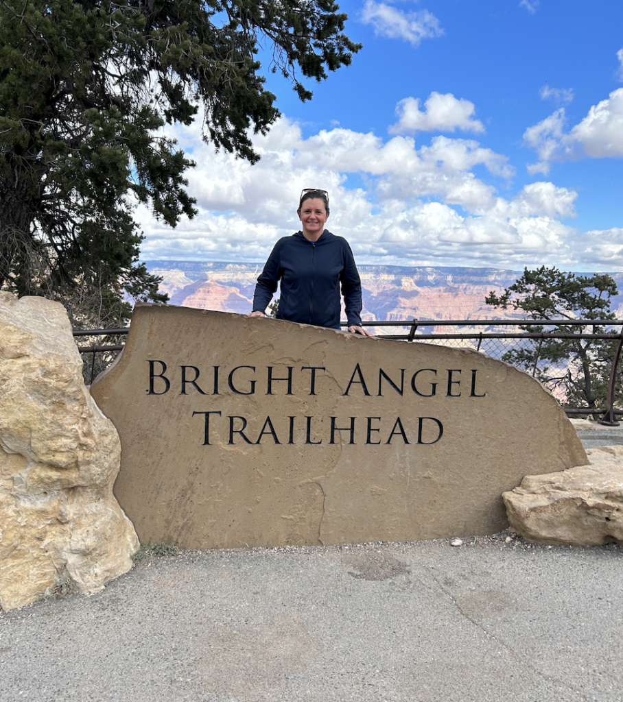
My heart sinks when I see a sign that the parking lot is full. I land a parking spot despite the sign. There are several spots available at 6am. I realize later that this sign just stays up all the time. I head to the trailhead but first the iconic highest point sign:

There is a sign that warns hikers that this trail is hot and exposed. Do you have 3L of water? Do you have sunscreen? Yes and Yes. I continue on. 

The first wildlife I see is on the trail the first 10 minutes – a Mountain Goat. It looks over at me and continues chomping on grass. I keep walking and I’m in awe.

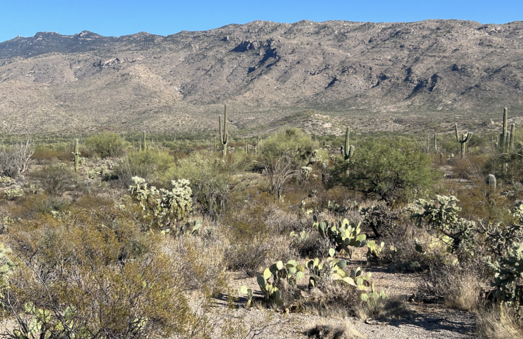
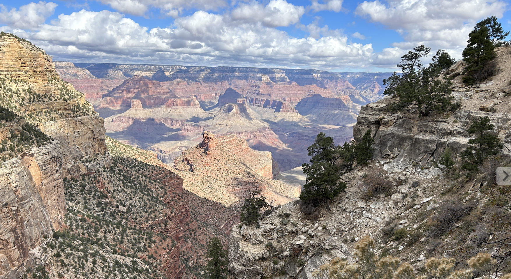
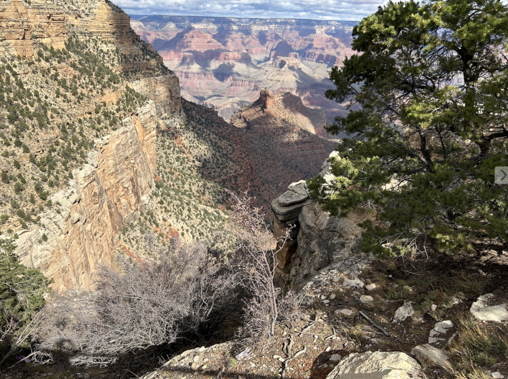
Garden Wall and the Continental Divide loom ahead. The view of the valley and mountains is like nothing I’ve seen. 

I’m still not sure how many miles I’ll hike. Ideally I’d like to make it to the chalet and then turn back. In retrospect I should’ve done the loop and taken the shuttle back, but I didn’t want to rely on a shuttle in case I’m stuck in heat or rain. So I opt for an out and back. 

This trail didn’t even open until July 11 and it’s July 29. Going to the Sun Road didn’t open until June 22. I see only snow on the high peaks in the distance. I really only picked these dates for the only open date at Glacier Park Lodge; everything was planned around the one night there, for tonight. But I digress. My hike:

I am following Garden Wall and am always looking up to my right. There are parts of that trail that seem long and flat, and there are some up and down. I hike past the ledge that hangs like a shelf but wasn’t really bothered by the trail. I held on to the hand cables a few times. I don’t have a fear of heights, a fear of many other things, yes, but not this. I could see the Going to the Sun Road below me and just didn’t look down much. 

I opt to turn around at 6.5 miles because there is full sun exposure and I’m getting worried about the trek back. I know I’m close to the trail to view Grinnell Glacier but I’m okay with turning back. I’ve gone farther than the original plan and am ready to go back. 

There are so many hikers and I listen to conversations. I hear one group talk about getting to the chalet for their overnight stay and I’m a bit jealous. I see families with children and two couples with a child in a carrier. I just hope they all have sunscreen and plenty of water. When I started out much of the trail was in the shade and now most of it’s in full sun. I lather on the sunscreen and hope I don’t fry. 

Going back the way I came is a different experience. I see everything I didn’t look back to see; one benefit of an out and back. This trail is spectacular and as I hike I know I want to come back and do the loop so I can see the chalet. I hike past the rock slide that has purple rocks. I saw it going out and the purple shade of the shale are stunning. This time, I take a rock as a reminder of this hike. This theft reminds me of my past thievery from Mount Washburn in Yellowstone National Park during my Western Park hiking adventure in 1988.  I took a rock from the summit and I had it as a souvenir for many years. I realized I didn’t have it anymore and it got lost in moves. I forgot about that rock until just this moment. This trip is all about remembering something special and that Mount Washburn rock memory was part of it. 

I get back to Logan Pass and I’m thrilled that I didn’t run into a grizzly and that I’m not burned to a crisp from the sun. I go to the Visitor Center and look around at the interpretive signs. I’m too tired to hike the trail to Hidden Lake which is just past the Visitor Center. It’s a 5 mile out and back. I think to myself, I’ll do it on the way back to Kalispell tomorrow after Grinnell Glacier

Now it’s time to look for food. As much as I’m a planner, I didn’t research places to eat east of Logan Pass. It turns out to be the hardest part of the day. 

I’m driving east on the Going to the Sun Road heading to St Mary’s Visitor Center area. I stop at the Jackson Glacier viewing and wish I was hiking toward it. Jackson Glacier is the 7th largest of the 25 glaciers in Glacier National Park. As I write this my plan next year is to hike in this area.

I continue on in search of lunch/dinner.

Unexpectedly, I see a traffic jam ahead. Initially I think it’s an accident. As I get closer I notice people looking to the north and their cameras are out. 

I look over and it’s a freaking Grizzly bear chomping on grass. I see the cinnamon color on his back and the sun reflecting on him and I’m thrilled. I’ve never seen one. I don’t stay long because I’m starving and need food. In retrospect I should’ve stopped but I always feel like gawking at wildflie is the wrong thing to do so I continue on.  Again, in retrospect, I should’ve gawked and taken photos.

I stop at the Visitor Center, where I miraculously find a parking spot. I go in, walk around and don’t buy anything. I am just hungry and need food. As I turn east, I see a restaurant sign hanging on a building in St. Mary’s Village just outside the park. I enter the building not knowing what I will find and by some, again, miracle, there is no waiting line and I sit at a table and order food.

I eat a real meal: a bison burger and bison chili, and a Montana brewed IPA. As I take in everything: the hike, the experience, the road, the people, the lakes, the rivers, the mountains – I did everything today that I planned to do. This is a big day.

I drive to East Glacier and home for the night at the historic Glacier Park Lodge where I visited in 1988. This is the place where I bought  a postcard from its gift shop while staying down the street in a hostel. I have a memory of the lodge and this trip is partially about going back and staying in this lodge. 

The lodge is as grand as I remember, or remember from the postcard. The room is not worth the nightly rate and I’m disappointed but the view from the back porch is worth everything. 

Tomorrow: Grinnell Glacier
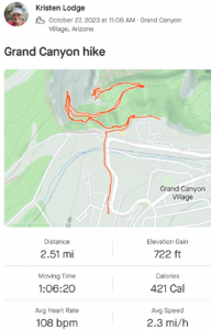
Distance: 13 miles.
Time: 4 hrs, 48 mins
What I ate: GORP, Kind Protein Bar
What I drank: 2.5 L water
What I wore: an old backpack, Title Nine skort, t shirt, Columbia long sleeve hiking shirt, Pistol Ultra baseball hat. 
What I saw: Mountain Goat, awesome views

Hiking Grinnell Glacier Trail in July

The road to Grinnell Glacier in the Many Glacier area of Glacier National Park is very remote and I’m a little nervous as I drive from East Glacier to the Grinnell Glacier trailhead. Yesterday I hiked the Highline Trail and probably didn’t eat and drink enough so I’m feeling under fueled. It’s 6am and the only thing I’ve eaten is a granola bar and water. I left Glacier Park Lodge at 4:30am and nothing is open to get a real meal before this hike. 

I enter the park with my bought-yesterday reservation to enter Many Glacier after 6am. I’m not feeling great about today’s hike and I see a sign for Many Glacier Hotel. I turn left into the parking lot to procrastinate my hike and explore this historic hotel. I park and walk into the lodge. There just so happens to be a beautiful breakfast buffet and I know this is my chance to fuel up and go into the Grinnell Glacier hike with a great mindset. 

I eat a full buffet breakfast: eggs, bacon, fruit, potatoes, coffee. I drink a second cup of coffee. To top it off, I have a view of Swiftcurrent Lake. I’m now in the right mindset. I’m not rushing. I’m not worrying. Well, maybe a little bit. I worry about getting a parking spot at the trailhead which fills up fast, like everything here in the summer at Glacier National Park. 

Additional good fortune: the weather is working for me – it’s overcast, cloudy and threatening rain. Yesterday on Highline trail after 10am I was in full sun burning to a crisp, or so I thought. 

After a full breakfast and contemplating my life mesmerized by the lake, I’m ready to hike to the glacier I hiked when I was 17. You see, I’ve been preparing for this hike for a while. I’ve been weightlifting, running and hiking. I’m 36 years older and know I need to be ready. I want to see that freaking glacier. 

I’m hiking solo but I have my InReach Mini 2 active and am communicating my plans with my BFF Mark. I’m not carrying bear spray but I do have bear bells. 

I land a good parking spot and head out on the 5 plus miles to Grinnell Glacier. There are bear warnings posted. I am hiking this trail solo only because it is a super popular trail and I don’t think I’ll be alone much.

I try to stay close to other hikers. I pass a group and look for the next group. I think I hike fast because I’m scared. And I’m trying to get through being scared faster. I keep looking for people and there’s tons of them; I’m rarely alone.

When I do have alone moments I sing songs. Out of nowhere comes a song I haven’t sung in a while. I’m deep breathing and these lines come out of my mouth “I’m just breathing, breathing in and out. Trying to get through this thing called life.” 

The last time I sang this song, not outloud, was when I was swimming in the Gulf during Ironman Florida. It’s such a great song. I’m trying to find people and hike with them for a little bit but then when I can’t I sing this song as loud as I can to keep the bears away: 

I’m just breathing. Breathing in and out. Taking it all in and I’m living with some doubt. I’m just breathing and I’m trusting in your words, knowing you can hear me Lord. You always take my breath away, sometimes you take me by surprise.” 

I talk to a lot of people and I get to the glacier overlook. The glacier is amazing. I don’t necessarily remember it but I’ve read so much about the glacier and how it has receded that I feel like I know it. I’m so happy to be here. It was a hard hike especially after yesterday’s hike. I rejoice in the beauty and not seeing a grizzly. 

I take a few pictures then head back.

I am wearing my Knoxville Motus race shirt on this trail because it’s the best feeling shirt next to my skin, and it wicks sweat a bit. I like being comfortable. A group passes me as I head down and the last man looks at my shirt and then asks me, You from Knoxville? I say yes. He tells me he is from Winchester. I say, isn’t it great to be out west? He smiles and asks, You a Vols fan? I say, don’t you have to be? 

I pass the family that offered to hike with them on the way up. They have a five-year-old daughter hiking the entire trail, which impressed me more than anything. I love seeing young kids hiking these trails; it will be a memory to last a lifetime, I’m sure of it. The father tells me there is a Bighorn Sheep ahead that I will see; I’ve never seen one.  

This is a life affirming hike today because I am fortunate for so many things at this moment. I’m so thankful and I pray a lot during this hike. I think about how I do so many of these adventures scared. I moved to Tennessee scared. I hiked Mount Washington in winter, scared. I left a bad job scared. I just do things scared. I’m very thankful for my friends who talk me down from the ledge when I get overwhelmed from doing things scared. 

As I hike back to my car, I’m so thankful to have a good day and that I get the chance to come back and visit this place I love. 

36 years ago I had no idea what my future held; I still don’t. Montana was always my dream; I say this all the time. Meaning that I thought I would live in Montana and make a life here one day. Maybe it was just a dream about a place to visit and get to know over time.  Who knows; there’s always time, there’s always time.

Regardless, today’s hike was one of the best days of my life. 

Distance: 10.2 miles.
Time: 3 hrs, 51 mins
What I ate: GORP, Kind Protein Bar
What I drank: 1 L water
What I wore: Salomon hydration vest, rabbit Speed Leggy Shorts, Motus race top, Glacier National Park hat. 
What I saw: Big Horn Sheep, mule deer, hoary marmot, columbia ground squirrel

Day Three – Petrified Forest National Park and Saguaro NP

We woke up at 5am knowing that we had to get to Tucson before Saguaro NP closed at 4pm. Total mileage from Cortez, CO to Tucson, AZ: 538 miles. 

This time when we drove past Petrified Forest National Park it was open so we went in. 

I thought this was a small park off the side of the highway, but it ended up being a spectacular one hour drive south through an amazing landscape. 

Petrified Forest National Park was more that I ever expected. The views from driving through were beautiful, like a painting.

The Petroglyphs were so interesting to see and learn about the history of who did this to the rocks.

We got out and read the signs and learned about everything in the park. We stopped and walked the Blue Mesa Trail. We learned about how the trees became petrified and the climate change that caused them to be petrified. 

The biggest lesson learned on this trip is I want to know more about where I’m traveling before arriving. I would’ve liked to hike more trails in Petrified Forest. But also, it is sometimes hard to image a place and read about it before going there. Now, I’m reading more about this area and it makes more sense after being there. 

After exiting from the South Entrance it was onward to Tucson. The scenery is canyon and rock and desert. So many prickly pear. The cliffs made of sandstone dotted the landscape. We are in Apache country now. We drove through Tonto National Forest at an elevation of 5,840. 

Some of the signs I saw:

Truck Crossing
Free Wifi Wendy’s
Speedway – Fresh Coffee
Elevation 4,983
8% grade
Winkelman City Limits
Entering Pinal County
Aravaipa Creek
Biosphere 2
Entering Pima County

Saguaro National Park was exactly how I left it in 2015 – Gorgeous. We drove the road that I had run in a race and biked several times. The paved, hilly road that passed hundreds of Saguaros. 

Then we drove into Tucson met Kassandra for dinner and then back to Phoenix. The last day was a lot of driving in a beautiful landscape. I miss Tucson and I would love to live here again some day.

Grand Canyon and Flagstaff in October

My original plan was to run the Javelina 100K. I signed up six months prior to the start date. 

Training didn’t go as planned. Blah blah blah. 

In September I decided that I would instead take a tour of National Parks and visit the legendary 4 Corners

My travel partner was Mark, who initially offered to crew my 100K race, then decided that touring the National Parks was a good vacation idea, too. 

I planned to see my friend Mary on Friday night to wish her well on the 100K but my plane was late and the lines for the car rental didn’t get me out of the airport until 11pm. [Note: Mary loved the race and wants to do it again, so I have a second chance to do it at some point.]

Saturday morning Mark and I left for the Grand Canyon at 5am. We drove past Sedona and Flagstaff wanting to spend as much time at Grand Canyon and Bright Angel trail as possible. Our only stop was for a late breakfast in Tusayan. I had the most amazing Huevos Ranchos. 

We got to the park and headed straight to Bright Angel. I wanted to go down at least 3 miles. I loved seeing the trail in the distance; I just wanted to hike to the river. We occasionally caught glimpses of the Colorado River.

The trail was steep in places but also leveled out for a nice break. It was nice to just take a leisurely hike into the canyon.

Usually my hiking plans take on a life of their own and I go go go. But this time it was a slow pace, checking to make sure Mark was good. He’s more of a road runner and doesn’t really hike – but is in great shape. He did well. 

We ended up hiking 2.5 miles with 722 feet of elevation gain. 

After visiting the shops on the South Rim we took the shuttle west and walked along the Rim Trail. We were able to see the Colorado River and stopped at the Powell Monument honoring Major John Wesley Powell who was among the  first to ‘run’ the Colorado River in Grand Canyon. 

I’ve read Stegner’s book about Powell, and have read so many historical stories about Powell. He was the person who warned the government about the west’s aridity that wouldn’t be able to sustain agriculture. He was also a scientist. He also advocated for removal of Indigenous, which no longer makes him a hero, in my view. 

It was a cold day in October to visit the park – so much better than sweating, which was the case the last time I visited the Grand Canyon in 2015. 

Mark and I drove back to Flagstaff past Humphreys Peak in the Coconino National Forest where we saw the devastation from the fires in 2022. In the picture below you can see the blackened tree trunks.

We had dinner in town and stayed the night in a hotel. It was a long day seeing northern Arizona. I can’t wait to go back. Mark and I have a plan to come back this coming October for a Rim to Rim hike.

Next up Route 66, 4 Corners and Mesa Verde.

Go see the world

“National parks are the best idea we ever had. Absolutely American, absolutely democratic, they reflect us at our best rather than our worst.”  —Wallace Stegner, 1983

I’ve just finished re-watching America’s Best Idea, the PBS special from 2009. In 1988 I wanted to go see the western National Park and signed up for a trip. Now, I just want to go see all the National Parks; I just want to go see the world. As much as I can. Ken Burns inspired travel.